Produce better
Advice adapted to climate and soil, plot by plot, based on NASA POWER (rainfall, temperature, water deficit) and SoilGrids (texture, pH, fertility).
Smart Agri 2.0 is our program for smallholder farmers. It brings together building blocks that already exist: plot mapping with GeoTrack Data, agro-climatic advisory, the PanafAgriConnect marketplace and, in the future, PulsarInfinite's pay-per-use machines.
Which crop for which soil? When to sow? Where to sell? The answers exist in open scientific databases, but they do not reach the plot.
Smart Agri 2.0 starts from the plot mapped in the field and links it to climate and soil data, then to the market.
Advice adapted to climate and soil, plot by plot, based on NASA POWER (rainfall, temperature, water deficit) and SoilGrids (texture, pH, fertility).
Plots are mapped as GPS polygons with GeoTrack Data, then imported into PanafAgriConnect with the boundary of each farm.
The “agricultural brain” divides a country into about 2,000 cells and calculates a score and suitable crops for each one.
Harvests are sold on PanafAgriConnect, with reference prices displayed next to listings.
Mills, hullers and solar cold storage on a pay-per-use basis: this is the role of PulsarInfinite, in development.
Free courses in French, English and Portuguese on PanafAgriConnect.
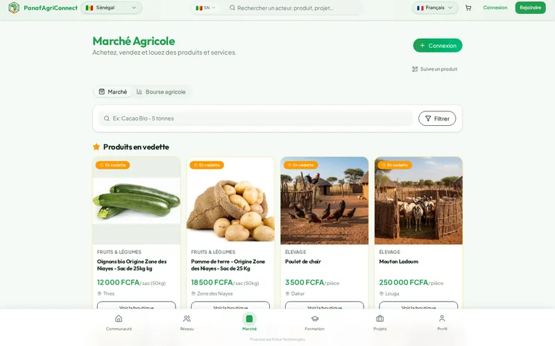
The social network and marketplace for African agricultural stakeholders, with market prices shown next to listings.
Learn more
Municipal tax collection, traced from the agent to the cash desk, with an app for residents.
Learn more
The management app for micro, small and medium-sized enterprises: stock, sales, customers, invoicing and an online storefront.
Learn moreWe assemble the Smart Agri 2.0 building blocks to fit your value chain and your territory.